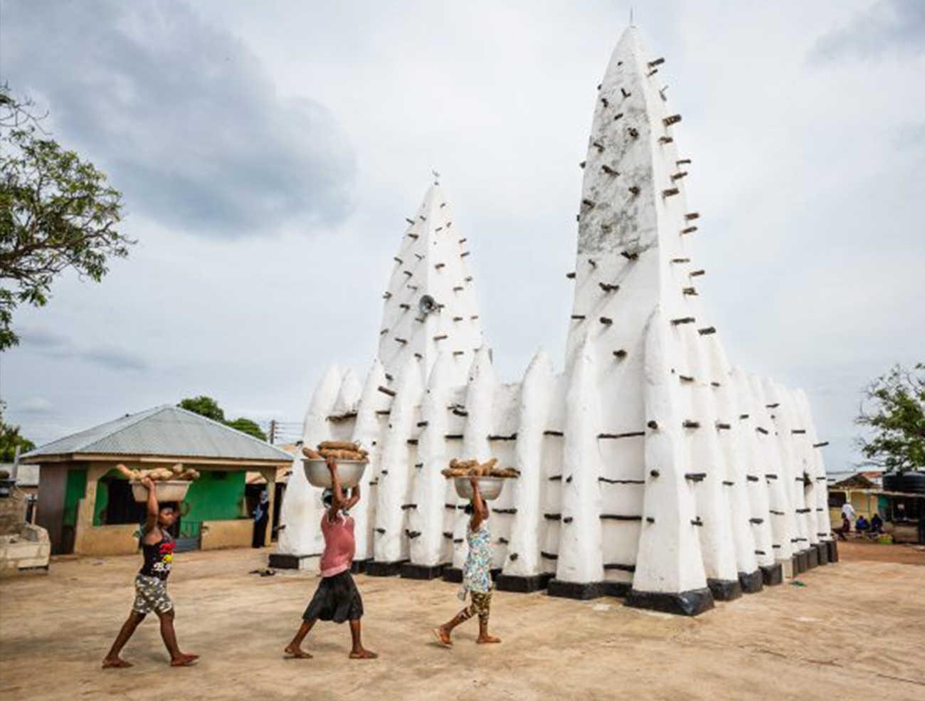
The Bono East Region
About Bono East
The Bono East Region is a new region carved out of the then Brong Ahafo Region. The capital of the new region is Techiman. Bono East covers a land area of 22,952 square kilometers and has a population size of about One (1) million people.
Tourist Sites / Attractions
The Bono East Region prides itself as one of the nation’s regions with amazing tourist sites. Due to the conservative nature of the people, their culture remains unspoiled by industrial development. Making it one of the most attractive in Ghana, with many beautiful tourist sites. Some of the nation’s most significant rivers which serve as attractions such as the Black Volta and River Tano run through the region and provides many economic benefits to the people.
Kintampo Waterfalls
At the point where the Pumpu River falls some seventy (70) metres (230 feet) down beautiful rocky steps to continue its journey towards the Black Volta at Buipe, is the Kintampo Waterfalls. Located 4km away from the Kintampo Township on the Kintampo-Tamale highway, it consists of three (3) unique stages that can be accessed by a footpath. The final stage offers an exciting twist as the tourist can only access the beautiful waterfall by descending a windy flight of steps. Receptive facilities are available for tourists.
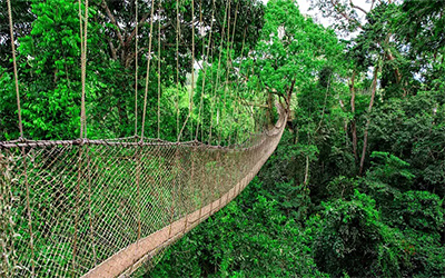
Kintampo Canopy Walkway
The canopy walkway which is an added value to the Kintampo Waterfalls has been constructed over a valley spanning 90 meters and 80 meters at two locations on the waterfalls. It is found that a maximum load of twenty (20) human being each weighing an average of 100 kilogram (approx. 220 pounds) will produce a total maximum tensile force of 101.6 KN in the three supporting thread-way cables. This translates to 35.5KN in each cable used for canopy walkway. This is far below the allowable tensile force of the cable used for construction, which is 427KN.
Therefore, the Canopy Walkway is structurally fit to withstand loads and can accommodate up to twenty (20) human loads walking on the bridge at a time making the tourist package exhilarating.
Fuller Falls
Located on the Yoko River, at Yabraso which is 7km west of Kintampo town. The Fuller Falls gently flows from the east over a series of cascades forming rapids on the Yoko River (a tributary of the Black Volta) at Yabraso. The waterfalls provide a tourist with a wonderful, peaceful, and refreshing, plunge pool surrounded with seats made of concrete and rocks where one can relax quietly and have a delightful view of the falls.
Boabeng-Fiema Monkey Sanctuary
The Boabeng Fiema Monkey Sanctuary located 22km north of Nkoranza makes for a great day out and hosts a rare breed of Monkeys who are considered citizens of the town. It is a superb sanctuary created in Nkoranza District in 1974 to protect the Sacred Monkeys that inhabit the forest around the villages of Boabeng and Fiema. The sanctuary is home to the black and white silky colobus and brown Mona monkeys which are an enchanting sight to behold. It is a taboo to kill any of the monkeys because they are held sacred by the people of Boabeng and Fiema. The monkeys have access to all parts of the village and local people plant fruit trees for them. When a monkey dies, it is buried in a coffin at the monkey cemetery and special funeral rites are performed. Receptive facilities are available for tourists who may want to spend the night or stay longer for research.
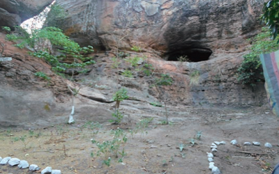
Buoyem Caves and Bats Colony
Hidden in a dry Semi deciduous forest in the small rural community of Buoyem in the Techiman Municipality. The site offers an exciting habitat tour package of sandstone rocks and waterfalls, caves and Rosetta fruit bats.
Tano Boase Sacred Groove
It is believed that the sacred grove is indeed the cradle of Bono Civilization. It is located in the Techiman Municipality. The grove served as a hideout for the Bono people during the Slave Trade and inter-tribal wars many years ago. It also serves as a place for recreation and religious activities.
Bono Manso Slave Market
An important landmark in the history of Slave Trade in the Bono East Region. Located at Bono Manso on the Techiman-Kintampo road. Bono Manso was the point where slaves from the North were taken for sorting purposes. The strongest of the captives were selected and sent to the coast leaving the weaker ones in the town. To date, African Americans and other Africans in diaspora visit the area to learn about their origin and history.
Forikrom Boten Shrine and Caves
Located about eight (8) kilometres off the Techiman-Nkoranza road, is a unique range of giant rocks, which forms a haven like sort of shrine and caves. During the tribal wars between Asante and Takyiman in the past, it is believed that the Magic Caves which is known as the biggest caves was a refuge for women and children.
Kintampo: Geographical Centre of Ghana
Kintampo is the Geographical Centre of Ghana. The exact point denoting the centre of Ghana is marked by a monument with Ghana’s coat of arms. The Kintampo town serves as a transit point for traders from the north to the south and vice versa. Due to its location, it attracts people from all walks of life. The Kintampo town is also known for its commercial activities and the famous Kintampo Health Training Institute. Also notable in Kintampo is the British Cemetery which once served as a Cemetery for Members of the Gold Coast Regiment.
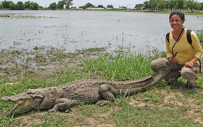
Digya National Park
Digya National Park which can be located at the Sene East District offers an unforgettable experience to interested tourists. This National Park is recommended for adventurous tourists since its accessibility proves to be a bit difficult. The park covers an area of 3,475km of undulating terrain with sandstone inselbergs. Lying on the Western border of the Volta Lake, it is found to be divided between the Bono East Region through Ashanti Region to the Eastern Region. Six (6) primate species especially the black and white colobus monkeys, elephants and varieties of antelopes inhabit the park to give the tourist a notable experience.
Experience Ghana
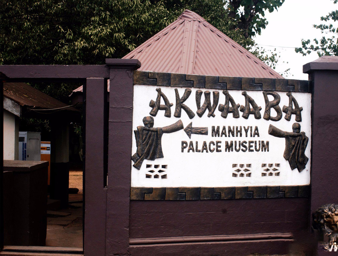
Manhyia Palace and others
About The Museum is a unique creation in West Africa by the Asante...
read more